
The Wilkesboros · Walk, ride & explore
Yadkin River Greenway in Wilkes County, NC
Plan a riverside outing in Wilkesboro and North Wilkesboro with the official section map, trailhead information and practical details for your walk or ride.
Start small and make it your own
A local river walk, with a plan that fits
The Greenway is a good way to add outdoor time to a visit to the two towns. Pick a named entrance, choose a comfortable distance, and leave time for a bench stop, a look at the river or a meal afterward.
Read the map as a network of different sections and connections. A short out-and-back from one access point is often easier to plan than a through trip that depends on every connecting section being available.
Official Yadkin River Greenway map
See section colors, trailheads, river access, parking symbols and sidewalk connections. Open the Council’s PDF when you want to save or print the full map.

Use + / − to zoom, then drag to move around. Keyboard: + / −, arrow keys, and 0 to fit the whole map. On a touch screen, tap + before dragging. The original section colors are preserved.
The map preview could not be displayed. Open the official PDF map for the full view.
Map: High Country Council of Governments, published by the Yadkin River Greenway Council, February 2025. Preview rendered from the official PDF; map content and credits are preserved.
Use the written distances below if you cannot read the map. Follow current signs and barriers on site, and check the linked construction notice before a through trip.
Section distances and trail colors
Distances follow the Council’s February 2025 map. The colors match the official map and the Greenway’s section signs.
| Section / segment | Trail color | Mapped length |
|---|---|---|
| River’s Edge Park | Blue | 1.95 mi |
| Fish Dam Creek | Brown | 0.54 mi |
| Moravian Creek | Gold | 0.82 mi |
| Mulberry Fields | Green | 1.86 mi |
| Historic Jefferson Turnpike | Orange | 1.01 mi |
| Memorial / Smoot Parks | Red | 1.16 mi |
| Lowe’s Trailhead to Cub Creek | Silver | 0.41 mi |
| Memorial Park to Mulberry Fields connector | Red / Green | 0.48 mi |
| Mapped network total | 8.23 mi | |
Proposed connection: the map shows a separate 0.80-mile Cub Creek Silver extension and labels the connection proposed. It is not included in the 8.23-mile total above; do not use it as a confirmed completed route.
Activity-specific TRACK Trail routes and older web descriptions can use different distances. The table follows one dated map consistently. Check the Council’s original map.
Choose a starting point
Use these six starting areas to plan your visit. Map searches open the named starting area; follow the marked trailhead and local parking signs after arriving.
North Wilkesboro · paved TRACK Trail
Mulberry Fields at West Park
1918 West Park Drive, North Wilkesboro, NC 28659A useful starting point when you want a paved route and a connection toward the two downtowns. Kids in Parks rates its TRACK Trail as accessible.
Before you go: During business hours, use the designated Greenway parking at West Park Medical Complex. Check signs and the exact route you need.
North Wilkesboro · Reddies River
Historic Jefferson Turnpike
702 13th Street, North Wilkesboro, NC 28659Start near the end of 13th Street for a walk along the Reddies River. This route adds the story of the former Giant Lumber Company log flume.
Before you go: Kids in Parks describes crushed-rock terrain and does not rate this TRACK Trail accessible. Its published route length differs from the map segment above.
North Wilkesboro · park & history
Smoot Park
Town facility listing: 103 Chestnut Street, North Wilkesboro, NC 28659Combine a Greenway outing with park time and the Overmountain Victory story. Follow the marked trailhead entrance when you arrive.
Before you go: Park facilities and the trailhead can have different entrances. Use the town’s facility information and posted signs; pool and rental schedules are separate.
North Wilkesboro · eastern network
Memorial Park
119 Wilkesboro Avenue, North Wilkesboro, NC 28659A town-park access point for the Memorial / Smoot portion of the network. The official map also shows the connector toward Mulberry Fields.
Before you go: Use designated parking and the signed Greenway entrance. Athletic fields, courts and reserved facilities may be in use.
Wilkesboro · check construction notice
River’s Edge / Becky’s Park
TRACK Trail listing: 1801 YMCA Boulevard, Wilkesboro, NC 28697The Rivers Edge TRACK Trail listing identifies this starting area near the YMCA. Confirm your intended turnaround before setting out.
Before you go: The town’s August 2026 notice affects part of the River’s Edge route and Moravian Creek parking/access. A mapped trail line does not confirm passage through the work zone.
West of Wilkesboro · reservoir area
Fish Dam Creek / W. Kerr Scott
Visitor information: 499 Reservoir Road, Wilkesboro, NC 28697For this end of the network, begin with reservoir visitor information and the official map to locate the Fish Dam Creek access you want.
Before you go: The listed address is for visitor information. Use the official map to locate base-of-dam access. The TRACK Trail here includes natural-surface walking and is distinct from the map’s Greenway segment.
Leave time for the walk back
Estimate your walking time
Choose a map segment or enter the one-way distance you plan to walk. Use the out-and-back option when you will return along the same path.
Time = walking distance ÷ assumed pace. This is an estimate, excluding breaks, crossings, hills and delays. It does not calculate a route or confirm that a connection is open.
This area is covered by the town’s August 2026 construction notice. Confirm current access before planning this walk.
Plan for your group and the trail surface
A short route with a clear turnaround can work better than trying to cover the whole network.
With children
Pair a manageable walk with time at Smoot or Memorial Park. The town also lists TRACK Trails at Smoot Park, Jefferson Turnpike and Mulberry Fields. Choose a nature activity from Kids in Parks before leaving, then set a turnaround that fits your group.
For a paved option
Look first at the Mulberry Fields at West Park TRACK Trail and its designated parking. Ask about the exact entrance and current conditions if you need a step-free route, a particular surface or nearby toilets.
For a different surface
Jefferson Turnpike uses crushed rock and is not rated accessible by Kids in Parks. Fish Dam Creek outings can involve natural trail surfaces. Do not assume that the word “Greenway” means every section is paved.
Share the path
Keep right, allow room for others, and give a clear warning before passing. Bicyclists should yield to walkers. Keep dogs on a short leash and remove waste. Bring drinking water, use marked crossings and respect private property beside the route.
The town’s visitor brochure provides trail etiquette; follow current posted rules and closures on site.
History along the river
The route is more than a place to get your steps in.
The Overmountain Victory story
The National Park Service connects the Smoot Park area with the Patriot muster of September 27, 1780. Interpretation beside the Greenway helps place the river corridor in that story. Read the NPS Wilkes County account before a history-focused walk.
A community project
The Greenway Council dates the effort to 1994, with the first phase opening on May 18, 2002. Residents, landowners and public partners helped make the network possible. Learn about the Council and its work.
Preview a route
The Council links recorded walks by Chris Scott. They can help you picture a route, although they do not establish today’s access or surface condition.

Make a little more of the day
Add a local meal or another stop
Choose a restaurant around the town where you finish, or keep a separate window for a museum or reservoir visit. Check the opening day and kitchen hours before adding a detour.
Also explore our W. Kerr Scott visitor guide, county history and local events calendar.
Check access and get local information
Use the organization responsible for the information you need.
Yadkin River Greenway Council
For network information, maps and ways to support the Greenway.
Park and construction information
For the River’s Edge / Moravian Creek work, use Wilkesboro’s construction notice or call Public Works at 336-838-0188. For town-park facilities, use North Wilkesboro Parks & Recreation.
In an emergency, call 911 and give your location, the posted section color and the nearest trailhead or landmark. The Council map explains its color system.
Greenway visitor questions
Where is the Yadkin River Greenway in Wilkes County?
It is a network of river-side trails and connections around Wilkesboro and North Wilkesboro, with an additional Fish Dam Creek section by W. Kerr Scott. Choose a named trailhead rather than navigating to the river in general.
How long is the Greenway?
The Council’s official February 2025 map lists 8.23 miles of Greenway sections and segments. That is a network total, not the length of one continuous loop. The same map shows other trails and a proposed extension separately.
Is it open all year?
Public-agency visitor information describes year-round use during daylight hours. Individual sections can close for construction, flooding or maintenance. Check the linked town notice and posted signs before your visit.
Can I walk from one end to the other without leaving a trail?
Plan from the map’s actual trail lines and sidewalk connections. Do not treat separate sections, proposed extensions or a construction zone as an uninterrupted path. The August 2026 town notice specifically says there is no official detour around the affected River’s Edge / Moravian Creek connection.
Is the Greenway suitable for wheelchairs or strollers?
Some routes are paved, while others use crushed rock or natural surfaces. Kids in Parks rates its Mulberry Fields at West Park and Smoot Park TRACK Trails accessible, but not the Jefferson Turnpike TRACK Trail. Confirm the entrance, current surface and any closures for the route your group needs.
Can I bring a dog or ride a bicycle?
Town visitor information identifies walking and bicycling as Greenway uses. Keep a dog on a short leash, clean up after it, and follow posted rules. Riders should yield to pedestrians and give a clear warning before passing. Ask the maintainer about powered devices before bringing one.
Why do some websites show different mileages?
The section descriptions, older brochures and activity-specific TRACK Trails can cover different routes or editions. This page uses the dated 2025 Council map for its comparison table; it identifies the source for separate TRACK Trail access information.
Are restrooms and drinking water available at every trailhead?
Do not assume every access point has open restrooms or drinking water. Facilities vary by park and season. Bring water and check the specific park or trailhead information before setting out.
Is this the same as a paddling trail?
This guide covers land-based Greenway outings. River-access symbols identify places to investigate separately for paddling; they do not establish current launch conditions, water levels or a safe river trip.
Share a useful Greenway tip
Help another visitor choose a starting point, understand a surface or find a nearby local stop. Include the date and section name when sharing conditions. For an official closure or maintenance issue, contact the responsible organization above.
Sources and image credits
Visitor sources were checked October 22, 2026. The map is the Council’s February 2025 edition; it is not a live closure map. Walking estimates and outing suggestions are editorial planning tools. This page is an independent local guide and is not operated by the Greenway Council or a park agency.
- Greenway Council: official February 2025 section map · map created by High Country Council of Governments.
- Greenway Council: section descriptions and current contact information.
- Town of Wilkesboro: August 24, 2026 construction notice.
- Town of Wilkesboro: visitor overview and North Wilkesboro: park facilities.
- Kids in Parks: Mulberry Fields, Jefferson Turnpike, Smoot Park, Rivers Edge and Fish Dam Creek access information.
- National Park Service: the Wilkes County Greenway and Overmountain history.
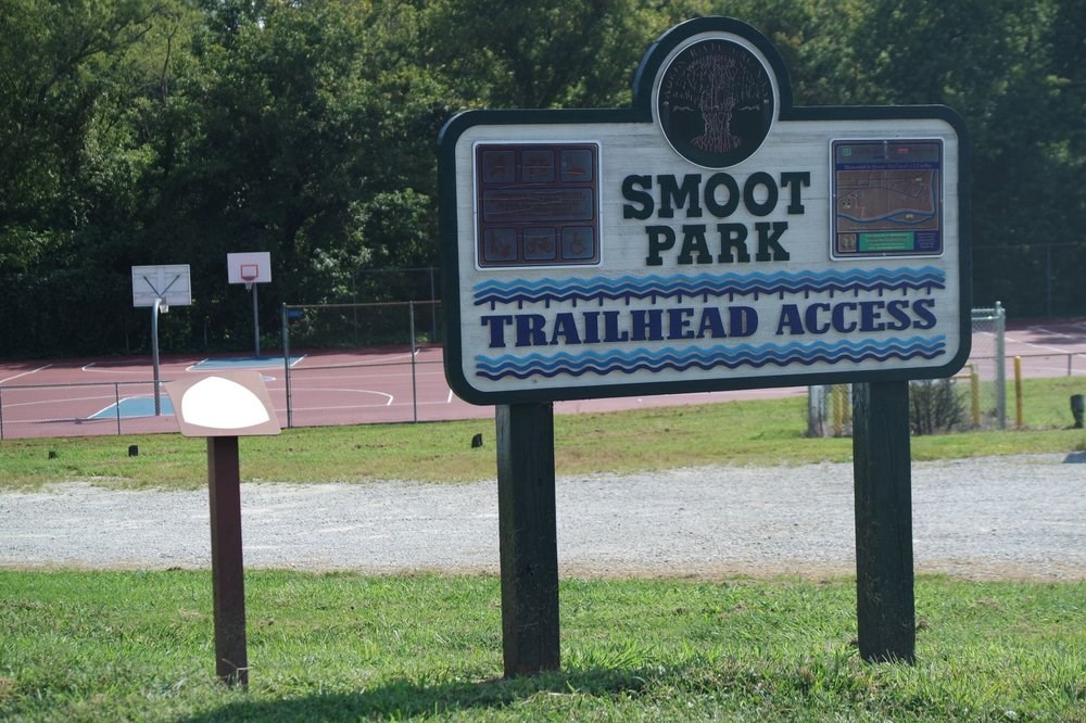
Trailhead photograph: National Park Service, Yadkin River Greenway — Wilkes County. NPS-created photograph, used with source credit under its published image-use information. The source page was last updated in 2019; the image is an archival view, not a representation of every current park feature. No claim to original U.S. Government works.
Nearby downtown photograph: Indy beetle, May 17, 2020, Wikimedia Commons source, CC0. Displayed with a responsive crop.
Map preview: rendered from the Council’s linked PDF with the original cartography, legend and credits intact. The PDF remains the source for saving and printing.
The Footer to Ridge banner is a sponsored placement. See our advertising and affiliate disclosure.